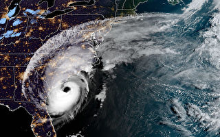
【大紀元2019年09月06日訊】(大紀元記者洪雅文綜合報導)颶風多利安(Hurricane Dorian)週五(9月6日)早晨登陸美國北卡羅來納州外灘哈特拉斯角(Cape Hatteras),立即減弱風雨威力,降級到1級颶風。
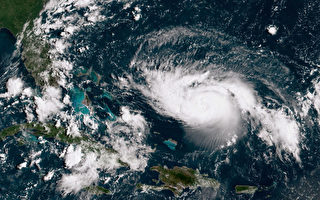
美國國家氣象局表示,多利安繼1日侵襲加勒比海巴哈馬群島後,接續襲擊了美國東部沿海,颶風時速一度達到90英里/小時。截至美東6日上午8點,多利安距離哈特拉斯角10英里的時候,時速已降至14英里/小時,並向東北移動。
該局預計,颶風將在6日下午開始遠離美國東海岸,加速向東北方向前往加拿大新斯科舍省(Nova Scotia)。多利安將於6日晚上和7日早上移至新英格蘭的東南部,並於7日晚些時候接近加拿大新斯科舍省。
Dorian will begin moving away from the US east coast this afternoon accelerating northeast toward Nova Scotia. Potential for tropical storm force winds across Cape Cod & the Islands & downeast Maine, with minor coastal flooding, rough surf & rip currents Northeast coast thru Sat. pic.twitter.com/mxAD7W9RKQ
— NWS Eastern Region (@NWSEastern) September 6, 2019
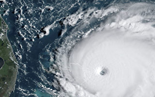
#Dorian has made landfall over Cape Hatteras, North Carolina at 835 AM EDT. Maximum sustained winds were estimated near 90 mph (150 km/h), and the estimated minimum central pressure was 956 mb (28.23 inches). More: https://t.co/tW4KeFW0gB pic.twitter.com/IgOso4dvvs
— National Hurricane Center (@NHC_Atlantic) September 6, 2019
儘管今早多利安登陸時風暴降級,但是北卡羅來納州的居民仍遭受相當程度的強風、大雨和洪水的衝擊。國家颶風中心(National Hurricane Center)在推特上發出警告,當地海岸附近地區將被上升的水域淹沒,並且可能會夾帶巨大、破壞性的海浪。
Normally dry areas near the coast will be flooded by
rising waters moving inland. The surge will likely be accompanied by large and destructive waves, and water levels could rise quite quickly as Dorian passes on the sound side of the Outer Banks. https://t.co/tW4KeFW0gB— National Hurricane Center (@NHC_Atlantic) September 6, 2019
在外灘上,預測人員表示,海浪的高度幾乎可以達到單層建築的天花板。據WTVD電視台報導,已有超過100萬人被警告離開卡羅來納州。該電視台首席氣象學家克里斯‧霍曼(Chris Hohmann)表示,颶風時速正在加速到15英里/小時,並可能在12小時內返回海上。
在奧克拉科克島(Ocracoke Island)經營霍華德酒吧(Howard’s Pub)的安‧華納(Ann Warner)通過電話告訴福克斯新聞,「(情況)這很糟糕,……我們的房子從來沒淹過水,現在水流在底層流動。」她補充說:「我們很安全。但這肯定是一團糟。」
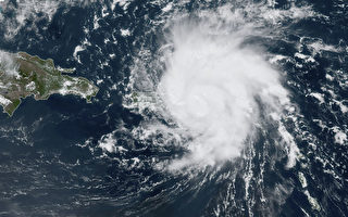
颶風多利安從1日開始,在巴哈馬群島造成最少30人死亡、數百人失蹤;卡羅來納海岸則有4人死亡;當時的風暴級數高達5級。#
責任編輯:林妍